


 4 / 14

MHPM_Boundary of the Cockpit Country and the Cockpit Country Protected Area Page
4
of
14
Please check against delivery
Mr. Speaker,
in deliberations on the boundary of the Cockpit Country; we first
sought to establish the scientific basis for defining the area
. As such, we relied
on the work of researchers who would have defined the contiguous, karstic
geomorphology of the area; which gives the unique conical hillocks and valleys
(
the upside down egg tray appearance).
The University of the West Indies
(Mona), under the leadership of Professor Dale Webber, was engaged some
years ago to undertake stakeholder consultations on the boundary of the
Cockpit Country and make recommendations, accordingly. In its 2013 report,
the University recommended that the Cockpit Country comprise three zones,
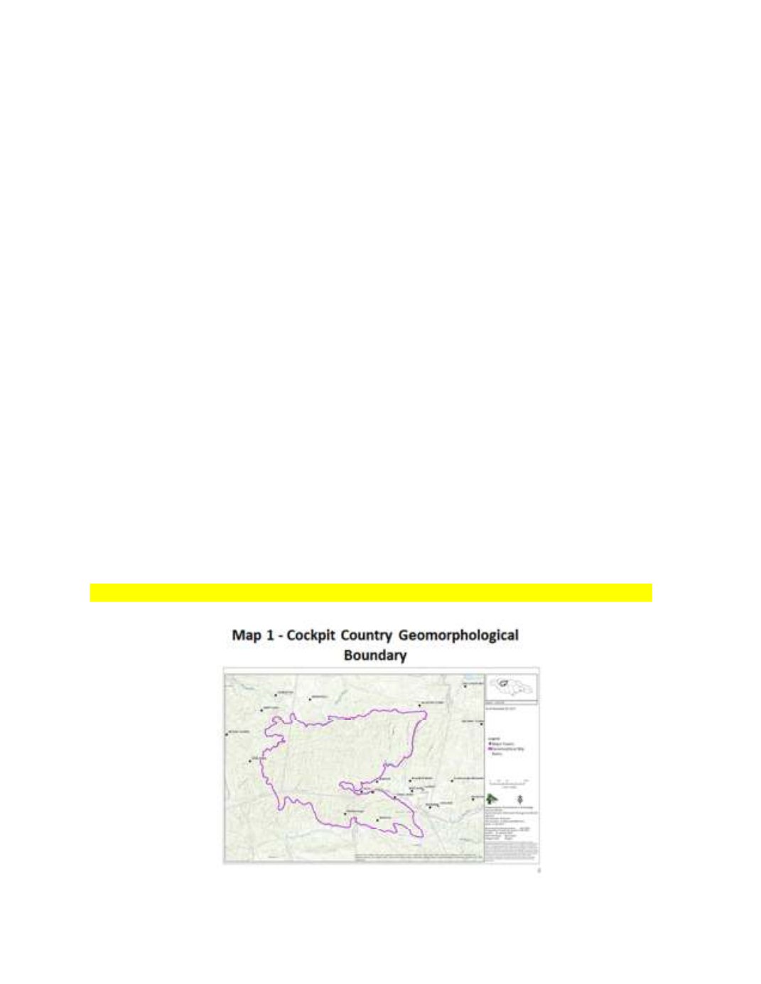
that is, (i) a core which is represented by the contiguous karstic geomorphology
of the area; represented by the boundary described by Parris Lyew-Ayee, Jnr
2005 report, (ii) a transition zone, commonly referred to as the National
Ecological Gap Assessment Report (NEGAR) Cockpit Add-on Boundary, and (iii)
an outer boundary or Cockpit Stakeholders’ Group Boundary.
Mr. Speaker,
the Parris Lyew-Ayee Jr. (2005) boundary is being recognized by
the Cabinet as the boundary of the Cockpit Country
by the State and is
depicted on
Map 1.
This boundary will be declared and gazetted.
Slide Map 1 – Boundary of the Cockpit Country (geomorphological boundary)